Travelling is the hobby of many people and it gives a pleasurable experience when you go to some new places full of natural habitat. Although humans have reached almost every point of the Earth and near it, still there are some remote destinations where human reach is almost impossible, or people never booked their ticket to such places because the route of these places is not mentioned in the maps.
[specialads]
10. Tristan Da Cunha

Tristan Da Cunha lies 2,816 kilometers (1,750 miles) from South Africa and 3,360 kilometers (2,088 miles) from South America. The closest land mass is Saint Helena, a mere 2,430 kilometers (1,510 miles) distant. Tristan was first discovered in 1506 by the Portuguese sailor Tristão da Cunha. However, Tristão was unable to land on Tristan because of accessibility difficulties and rough seas. Despite it, Tristão named the island ‘Ilha de Tristão da Cunha’ – roughly translated as ‘The Islands of Tristão da Cunha’. The name was changed to Tristan Da Cunha at a later date.
9. Devon Island
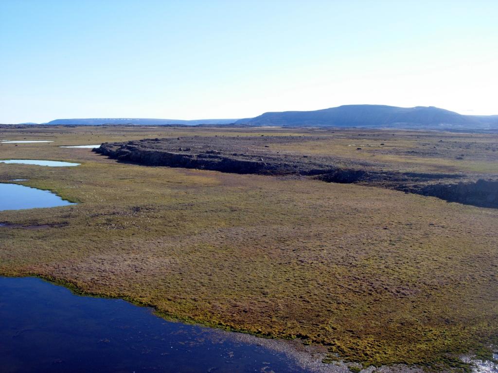
Devon Island is the largest uninhabited island on the planet, and it’s about as Mars-like as it gets. It’s home to the 14 mile-wide Haughton Crater, which is cold, dry, rocky and extremely isolated. Since 1997, Pascal Lee, a planetary scientist at the Mars Institute and the SETI Institute, and director of the Haughton-Mars Project at NASA Ames Research Center has led missions every summer from a small research station there to prepare people and design technologies for a trip to the Red Planet. On the island, researchers have tested robots, spacesuits, drills and other tools that would aid future Mars explorers. It’s also a proving ground for would-be Mars colonists. Devon Island is isolated, the environment is brutal and the area is poorly mapped, which makes it the perfect place to get a taste of what might go wrong out there.
8. South Pole

The South Pole is an inherently dangerous place. Stay hydrated and be aware of altitude sickness effects. Dress warmly and carry dry clothes and a radio if traveling away from the station. Do not travel on days with less than 1/16th-mile visibility. Read the Fire Safety Guide. Be trained on equipment and vehicles and obtain permission prior to use. Be aware of smoking policies. The station is at an elevation of 2,900 meters; however, the equivalent pressure elevation, based on polar atmospheric conditions, will vary from 3,300 to 4,000 meters. No landmarks are visible on the 3,000-meter-thick plateau of ice. (They actually sell sweatshirts with the saying: “Ski South Pole: 2 miles of base, 2 inches of powder”) South Pole Station is 1,350 km from McMurdo Station and is supported entirely by special ski-equipped planes, among them the LC-130 planes operated for the U.S. Antarctic Program.
7. Bouvet Island
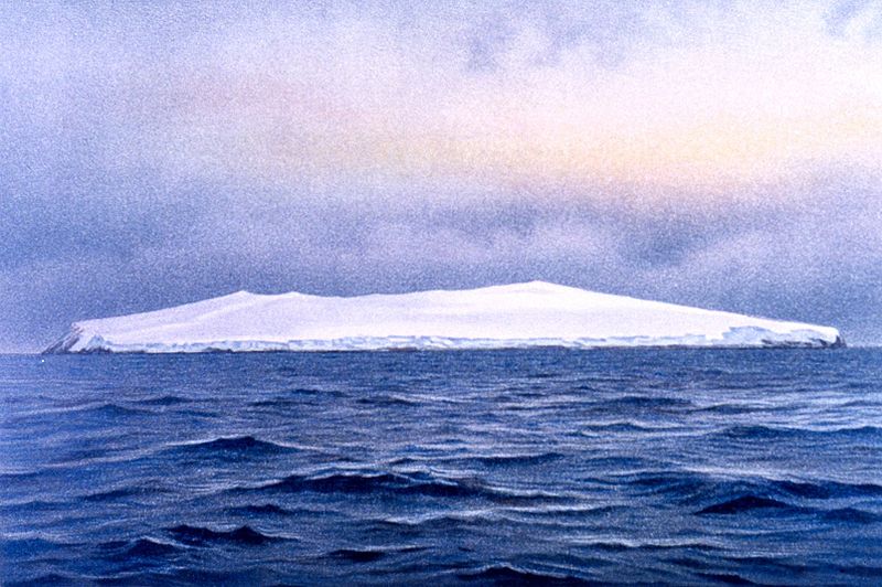
The freezing subantarctic Bouvet Island is literally in the middle of nowhere; located in the South Atlantic Ocean, it is known for being the most remote island in the entire world. A Norwegian dependency, it is a very small, uninhabited island, and is now classified as a nature reserve after a weather station operated on it for a few months during 1978 and 1979. Aside from its unfathomable isolation, there doesn’t seem to be anything all that special about this island at first glance.
In 1964, British Lieutenant Commander Allan Crawford and a team were sent to Bouvet Island by helicopter, to research a new piece of land that had popped up on the island due to volcanic activity. Here’s where it gets a bit weird. When they arrived, they found something very unusual. On this new patch of land, which had only been there for around ten years, the team came across an abandoned lifeboat, floating in a lagoon. The cars were on the shore, along with a copper tank. There were no signs of any people or bodies, and the boat was unmarked and thus unidentifiable as belonging to anyone in particular.
[postads]
6. Pacific Ocean’s Mariana Trench
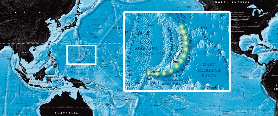
While thousands of climbers have successfully scaled Mount Everest, the highest point on Earth, only two people have descended to the planet’s deepest point, the Challenger Deep in the Pacific Ocean’s Mariana Trench.
Located in the western Pacific east of the Philippines and an average of approximately 124 miles (200 kilometers) east of the Mariana Islands, the Mariana Trench is a crescent-shaped scar in the Earth’s crust that measures more than 1,500 miles (2,550 kilometers) long and 43 miles (69 kilometers) wide on average. The distance between the surface of the ocean and the trench’s deepest point—the Challenger Deep, which lies about 200 miles (322 kilometers) southwest of the U.S. territory of Guam—is nearly 7 miles (11 kilometers). If Mount Everest was dropped into the Mariana Trench, its peak would still be more than a mile (1.6 kilometers) underwater. The Mariana Trench is part of a global network of deep troughs that cut across the ocean floor. They form when two tectonic plates collide. At the collision point, one of the plates dives beneath the other into the Earth’s mantle, creating an ocean trench. The depths of the Mariana Trench were first plumbed in 1875 by the British ship H.M.S. Challenger as part of the first global oceanographic cruise. The Challenger scientists recorded a depth of 4,475 fathoms (about five miles, or eight kilometers) using a weighted sounding rope. In 1951, the British vessel H.M.S. Challenger II returned to the spot with an echo-sounder and measured a depth of nearly 7 miles (11 kilometers).
5. Ellesmere Island
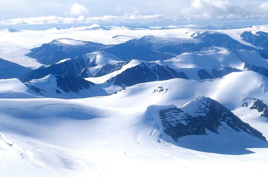
Ellesmere Island in Nunavut is the northernmost populated place in Canada. The world’s tenth largest island, Ellesmere Island has one small community (Grise Fiord) which is reachable by air (from Resolute Bay on Cornwallis Island) or – seasonally – by the sea in summer. A far northern military base (CFB Alert) and weather station (Eureka) are reachable only by aircraft. Ellesmere Island is the northernmost populated place on Canadian land, 4654km north of Middle Island and Point Pelee. The island, roughly 300 miles wide by 500 miles long (500 km wide by 800 km long) and covering an area of 75,767 square miles (196,236 square km), is the most rugged in the Canadian Arctic Archipelago, with towering mountains (especially in the north), vast ice fields, and a deeply indented coastline. Cape Columbia, at latitude 83°07′ N, is the most northerly point of Canada, and Barbeau Peak, at an elevation of 8,583 feet (2,616 meters), is the highest point in Nunavut. Settlements, all quite small, include Eureka, Grise Ford (Aujuittuq), and Alert, a weather station and military outpost that is the northernmost community in North America. Petroleum deposits have been discovered on the island. During the summer of 2008, large portions of the Ayles, Markham, Ward-Hunt, and Season ice shelves carved into icebergs.
4. Easter Island
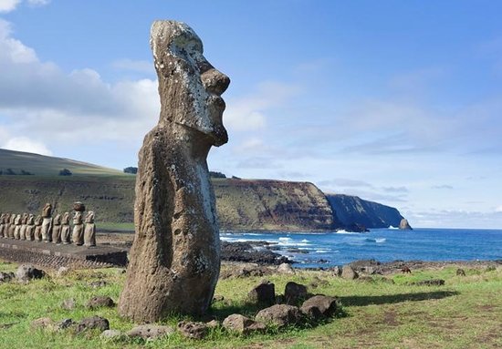
It is one of the most isolated islands in the world, but 1200 years ago a double-hulled canoe filled with seafarers from a distant culture landed upon its shores. Over the centuries that followed a remarkable society developed in isolation on the island. For reasons still unknown they began carving giant statues out of volcanic rock. These monuments, known, as “moai” are some of the most incredible ancient relics ever discovered. The people of Easter Island called themselves the Rapa Nui. Where did they come from and why did they disappear? Science has learned much about the enigma of Easter Island and has put to rest some of the more bizarre theories, but questions and controversies remain.
3. Point Nemo
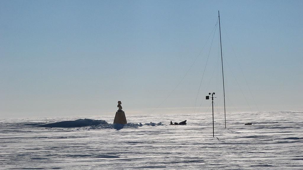
Where do you go to get away from it all? When the stress of everyday life pushes you to search for the most remote point on Earth, you might be surprised to learn there are actually a few to choose from. But if you have decent sea legs, nothing beats the furthest point from land, also known as the “oceanic pole of inaccessibility”. Since its official title is a bit of a mouthful, it has been nicknamed Point Nemo, after author Jules Verne’s famous seafaring anti-hero Captain Nemo. The name means “no-one” in Latin, which is fitting for a place so rarely visited by people. Point Nemo is located over 1,000 miles (1,600km) equidistantly from the coasts of three far-flung islands. Ducie Island (one of the Pitcairn islands) is to the north, Motu Nui (of the Easter Island chain) is to the north-east and Maher Island (off the coast of Antarctica) is to the south.
2. North Pole
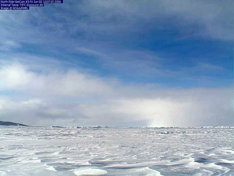
The “North Pole” refers to multiple places: the geographically northernmost point on Earth, the magnetic north, and, most enchantingly, Santa’s headquarters. The North Pole has inspired human imagination, scientific exploration and political conflict for decades. The Geographic North Pole is the northernmost point on the planet, where Earth’s axis intersects with its surface. Its latitude is 90 degrees north, and all longitudinal lines meet there. From there, every direction one turns is south. Because all longitudinal lines begin from it, the North Pole has no time zone. The pole is in the Arctic Ocean, where the water is 13,400 feet (4,084 meters) deep and usually covered with drifting ice 6-to-10 feet (1.8 to 3 meters) thick.
1. International Space Station (ISS)
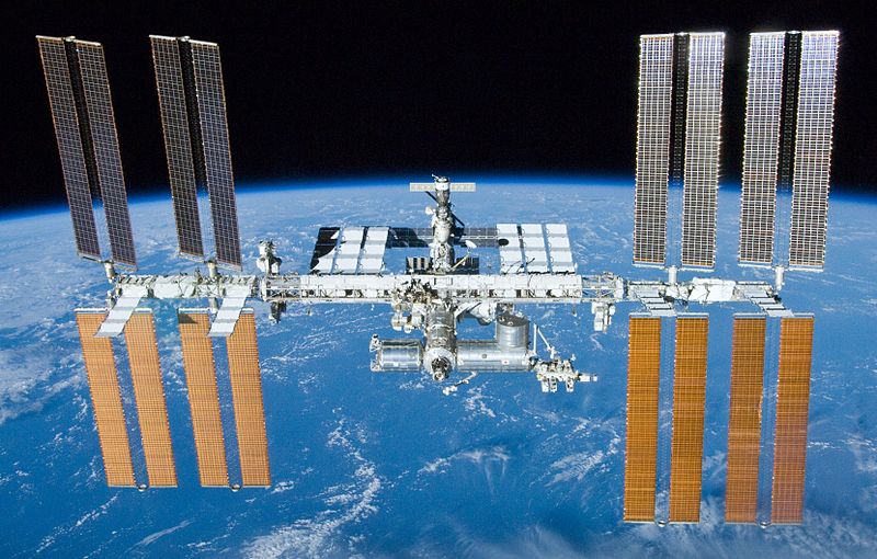
The International Space Station (ISS) is the most complex international scientific and engineering project in history and the largest structure humans have ever put into space. This high-flying satellite is a laboratory for new technologies and an observation platform for astronomical, environmental and geological research. As a permanently occupied outpost in outer space, it serves as a stepping-stone for further space exploration. It includes Mars, which NASA is now stating is its goal for human space exploration. The space station flies at an average altitude of 248 miles (400 kilometers) above Earth. It circles the globe every 90 minutes at a speed of about 17,500 mph (28,000 kph). In one day, the station travels about the distance it would take to go from Earth to the moon and back. The space station can rival the brilliant planet Venus in brightness and appears as a bright moving light across the night sky. It can be seen from the Earth without the use of a telescope by night sky observers who know when and where to look.
[postads]
Also Read: 15 ISOLATED PLACES ON THE PLANET WHERE YOU CANNOT GO


